
Walk a Kapolei Street Record
A reliable Kapolei street directory search is parcel-led, not household-led. Honolulu GIS turns the written address into a Tax Map Key, or TMK. The Real Property Assessment Division then connects that TMK to a tax parcel and current assessment owner. The statewide Bureau of Conveyances uses the same parcel key, legal description, party names, and document numbers to trace title. Each stop answers a different question.
- Copy the full address, including the 91- or 92- prefix, street type, unit, and ZIP. Keep all zeroes and punctuation.
- Use Honolulu GIS to identify the parcel polygon and TMK. Save the mapped site address and nearby parcel context.
- Search RPAD by site address or the portal’s 12-digit parcel number. Record the owner, mailing address, assessment date, and sales information as labeled.
- Carry the TMK or instrument number into the Bureau of Conveyances. Match the legal description before following grantors and grantees backward.
- Check DPP permits and address records for changes to the site. Use a dated directory only when the question concerns older occupancy.
This flow prevents the most common mistake: treating one owner field as a list of all residents. A tax roll identifies the assessment owner. A deed identifies parties to an instrument. A permit identifies people or firms tied to a project. None is a live household roster.
Read Kapolei Addresses Exactly
The 91- and 92- number prefixes are fast local checks. Removing a prefix can produce no result or point to a different Oʻahu address. Preserve the unit, street type, zeroes, apostrophes, ʻokina, and source capitalization. If a form rejects a mark, save the original and note the plain-keyboard version tested.
Place labels also shift. A street that residents call Kapolei may appear with Ewa, Waipahu, a postal label, the Makakilo-Kapolei-Honokai Hale board area, or the City and County of Honolulu. That is not a reason to combine unrelated hits. Compare the exact street number, TMK, ZIP, and legal description.
Insider tip. A complete 91- or 92- address plus its TMK is a safer match than a bare street name shared across place labels.
Search Kapolei RPAD by Address
The Honolulu RPAD property search accepts a location or site address and a parcel number. The official guide uses a 91- address example and says the street suffix may be omitted. A parcel result can show the owner name, site address, mailing address, land and building descriptions, current and historical assessment details, classification, tax relief, and sales history. The accessible guide did not establish an owner-name search field.
| Search Route | Input | Required | Use in the Street Directory |
|---|---|---|---|
| Location or site address | Text | One search alternative | Find the parcel from the full street number |
| Parcel number or TMK | 12-digit portal form | One search alternative | Open one exact parcel record |
| Board Appeals | Separate route | No | Assessment appeal context, not resident search |
| Map | Route or button | No | Move to parcel geometry and adjacent sites |
| Owner name | Not verified | Not verified | Do not claim this mode exists |
The RPAD record examples are shown in the official page captured below. Open the RPAD examples and code explanations before interpreting an unfamiliar field.
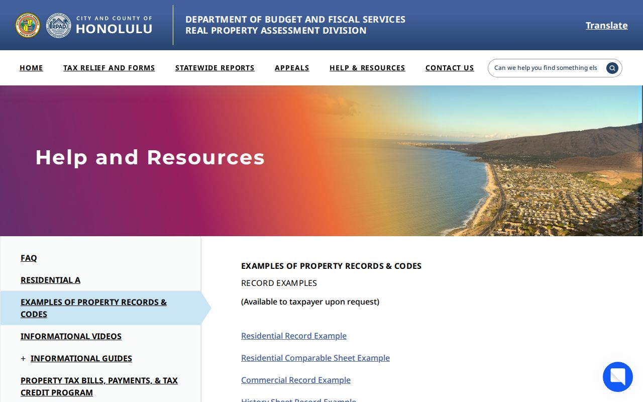
The examples distinguish residential, comparable, commercial, history, and base-lot records. They help decode the parcel card, while the live parcel and its assessment year remain the source for the address being checked.
Kapolei Site and Mailing Addresses
RPAD uses two address roles that must not be merged. The site or situs address is the physical parcel location. The mailing address is where assessment correspondence goes. It may be another Kapolei address, a post office box, an off-island address, or an address used by a representative. Either can change.
This difference is the key quirk in a by-address search. A mailing address outside Kapolei does not show that the owner moved there. A matching site and mailing address still does not identify every occupant. Save both fields with the assessment year and labels, then turn to a second official record if the person’s role matters.
Note: A home-exemption field is tax-system evidence for its assessment period, not a current list of everyone who occupies the property.
Map Kapolei Streets Through GIS
The official Oʻahu parcel layer exposes the bridge from the street to RPAD. It includes the parcel polygon, TMK, site and mailing attributes, ZIP, place labels, an owner attribute where populated, and a qPublic link. Its geometry is a visual reference, not a legal survey. Metadata dated in April 2026 should be checked for a newer service snapshot.
| GIS Field | Kind | Street Use | Caution |
|---|---|---|---|
TMK / parcel | Identifier | Connect polygon to RPAD and BOC | Keep exact format |
qpub_link | URL field | Open the assessment record | May be blank |
site_addre | Address | Filter or identify a site | Check spelling and units |
mailing_ad | Address | Compare tax correspondence | Not occupancy proof |
zip_code, city, island | Geography | Narrow a map query | Not a voter filter |
| Shape / geometry | Polygon | Browse parcels along frontage | Not a surveyed boundary |
The GIS capture below comes from that parcel service. Follow the Oʻahu parcel-layer record for current fields and metadata.
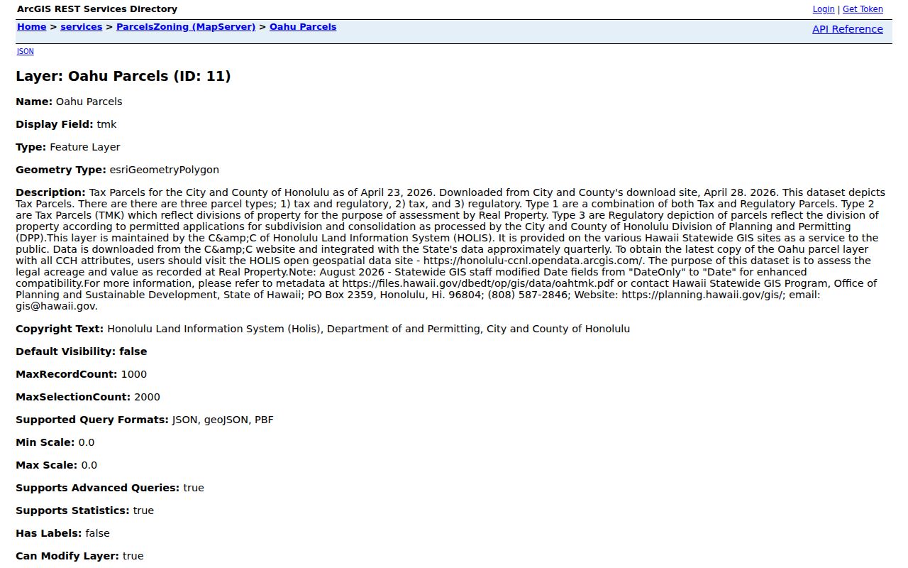
The service supports street-by-street work by map extent or field query. No official text confirmed a one-click buffer, radius, or select-all-street tool, so use visible polygons or documented ArcGIS query controls and state the method.
Kapolei Records Keyed by Street
Several public systems accept an address or parcel key, yet each describes a different role. The coverage table keeps those roles and access channels clear. When an online result is missing, the correct fallback is the custodian’s office, written request, or library, not an unsupported conclusion that the record never existed.
| Address Record | Custodian | What It Adds | Access Route |
|---|---|---|---|
| Parcel card | Honolulu RPAD | Owner, site and mailing addresses, assessment and site facts | qPublic, Kapolei counter, or record request |
| Parcel GIS | DPP / City GIS | TMK, mapped geometry, attributes, nearby parcels | HoLIS and ArcGIS services |
| Deed index | DLNR Bureau of Conveyances | Grantors, grantees, instruments, and legal descriptions | Online from 1976; counter or written search before then |
| Permit file | DPP | Application, status, approvals, review, and project context | HNL Build; full file from DAIB |
| Voter record | Honolulu Elections | Public name, precinct designation, and status | Individual self-check or restricted official file request |
| Historic directory | Libraries and archives | Dated name, address, telephone, or organization listing | Catalog, film, digitized book, or reference desk |
Kapolei has no separate city recorder. Deeds go to the statewide Bureau of Conveyances, while RPAD, DPP, and elections are City and County of Honolulu functions. A narrow request under the Hawaiʻi Uniform Information Practices Act can seek a specific DPP or municipal file not posted online. The Office of Information Practices gives a normal response frame of 10 business days, or 20 business days in extenuating circumstances, with possible search, review, segregation, copy, and delivery charges.
Follow Kapolei Deeds Along Streets
The Bureau of Conveyances Document Search is the statewide title index. Create an account to search and view a blurred preview at no charge. Full images are paid. BOC states that online public research begins in January 1976. Earlier instruments require the Public Reference Room or a written search request.
- Parcel
- A mapped unit of land identified for assessment by its TMK.
- Situs address
- The physical site address, distinct from the tax mailing address.
- Plat
- A recorded map or plan that identifies lots, blocks, and subdivision details.
- Grantor and grantee
- The party conveying an interest and the party receiving it in a recorded instrument.
- Criss-cross directory
- A historic address-first publication. A specific local title and run remains unverified.
- Save the current RPAD owner, TMK, legal description, and every instrument number shown in sales history.
- Search the BOC document number first. If needed, search the owner as grantee and compare TMK, date, and legal description.
- Record the grantor, grantee, instrument type, recording date, system, and linked prior documents.
- Take the seller or grantor and search backward as an earlier grantee on the same legal description.
- At the 1976 cutoff, use the BOC Public Reference Room or written form rather than calling the chain broken.
The Public Reference Room is at 1151 Punchbowl Street, Room 123, with stated business-day hours of 8:15 a.m. to 3:30 p.m., except holidays. Written requests need contact details and known document, party, date-range, address, or TMK facts. The official page describes a $35 per-document charge plus $10 processing for its pre-1976 written certified search route. Confirm current fees before ordering.
Kapolei Permits Explain Site Changes
DPP permit records can explain a new dwelling, an added unit, a changed address, or a project that altered the site. HNL Build became the current permit system when DPP moved permit applications there on August 4, 2025. The documented legacy search uses an application or permit number, or a TMK. Result instructions identify Details, Approvals, Plan Reviews, and Staff Assignment.
The DPP permit and address FAQ also routes address-to-TMK work through GIS. Its captured page appears below and provides the source path for full records and address questions.
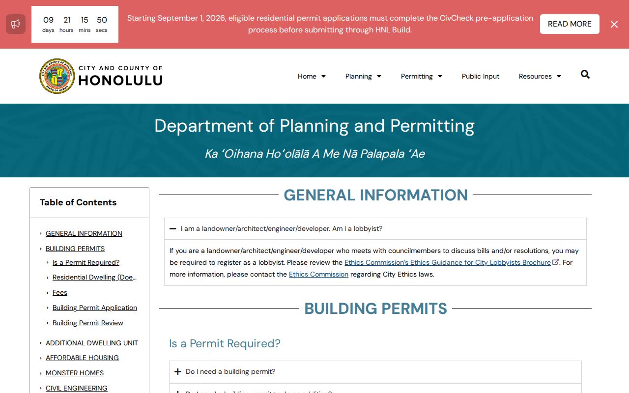
A status screen is not the whole permit file. Plans and related records go through the Data Access and Imaging Branch at 808-768-8277 or dppdaib@honolulu.gov. Code notices use the Code Compliance Branch and remain subject to release limits. In-person options include the Kapolei Building Permit Center at 1000 Uluohia Street and DPP headquarters at 650 South King Street.
Kapolei Streets Are Not Voter Rosters
Hawaiʻi’s online voter service confirms the registrant’s own record. It asks for name, date of birth, the last four Social Security digits, and a Hawaiʻi driver license or state ID number. There is no public web form that takes a street and returns everyone registered there.
HRS §11-97 makes the voter’s full name, district or precinct designation, and status public. Other affidavit information is confidential except for election or government purposes. A full voter file requires an official request to the Honolulu Elections Division and an election-related purpose. This makes the voter layer far narrower than a parcel search.
For an individual status question, use Online Voter Registration or contact Honolulu Elections at 808-768-3800. Keep a voter role separate from an owner, deed party, applicant, or historic directory listing.
Historic Kapolei Streets Need Context
The verified directory shelf is mostly Honolulu and island-wide material that predates modern Kapolei street patterns. Exact reverse or criss-cross titles for Honolulu or Oʻahu were not verified in the accessible official sources. Ask Kapolei Public Library for referral, then check UH Mānoa, the Hawaiʻi State Library, State Archives, FamilySearch, and the Hawaiian Historical Society.
Search a dated volume by the publisher’s geography. Try Ewa, Waipahu, Barbers Point, ʻEwa Plain, and Oʻahu before deciding a name is missing. A directory can suggest an older listed occupant, but only for its issue period. The Kapolei city directories section covers the publisher runs and how to read entries without turning them into modern ownership evidence.
No official source established a Kapolei-wide street renumbering year. Do not invent one. If the address changed, use a plat, legal description, permit, or DPP address record to connect the old label to the present parcel.
Limits on Kapolei Street Lookups
A street directory cannot reveal every renter, family member, visitor, or unlisted resident. DMV data is protected under the federal Driver’s Privacy Protection Act. Utility customer lists, private association rosters, and delivery routes were not found as public Kapolei data sets. Protected voter information and Hawaiʻi Address Confidentiality Program substitute addresses must not be reverse-engineered from adjacent parcels or other files.
Lawful use. Use Kapolei address records for lawful personal research only, and never use them to stalk, harass, intimidate, or harm anyone.
If a public source stops at a substitute address, sealed file, or confidential field, stop there. An authorized requester can contact the custodian and provide the required basis. A map or nearby owner list is not a way around the protection.
Note: Label each result with its role and date, since an owner, grantor, permit applicant, voter, and directory listing do not mean the same thing.