
Kapolei ZIP Directory Coverage
Official sources support one primary Kapolei delivery ZIP and several nearby or secondary codes that need address-level verification. The Hawaiʻi Department of Health table identifies 96707 with Kapolei. USPS material also places Kapolei in rows involving 96709 and 96797, but the inspected sources did not establish their current delivery class. Adjacent Ewa and Waipahu labels add another source of mismatch.
| ZIP | Official Area or Label | Post Office | Kapolei Search Note |
|---|---|---|---|
| 96707 | Kapolei | Current station name not captured | Primary ZIP to test; postal area is broader than the CDP |
| 96709 | USPS material uses a Kapolei preferred-city reference | Delivery class not verified | Confirm through a full street address before use |
| 96797 | Kapolei reference in postal material; Waipahu context elsewhere | Facility and class not captured | Does not prove a parcel is in the Kapolei CDP |
| 96706 | Ewa Beach and Ewa | Facility name not captured | Adjacent code near the Ewa and Kapolei edge |
| 96759 | Regional public-health grouping | Not located | Analytical context only, not a verified delivery conclusion |
No official Kapolei ZIP split or realignment date was found. Nor did the captured sources prove that a secondary code is PO-box-only or unique. The Kapolei ZIP code directory therefore keeps those gaps visible. USPS ZIP-by-address is the proper test for a real, non-sensitive address.
Kapolei ZIP and CDP Counts
Census QuickFacts reports 21,411 people in the Kapolei census-designated place in 2020. The DOH ZIP table gives a population context of 46,928 for 96707 during the 2015–2019 ACS period. Both figures can be correct because they describe different geography and time frames. The larger ZIP-area number must not be labeled as the Kapolei CDP population.
This numerical mismatch is a useful boundary check. “Kapolei” may mean a census place, postal preferred city, neighborhood-board area, City and County address, or a broad west-Oʻahu place. Preserve the geographic label printed by the source. A resident search by ZIP should never flatten all those areas into one city-limit list.
Boundary key. A 96707 result identifies delivery geography, not automatic membership in the Kapolei census-designated place.
Verify a Kapolei ZIP
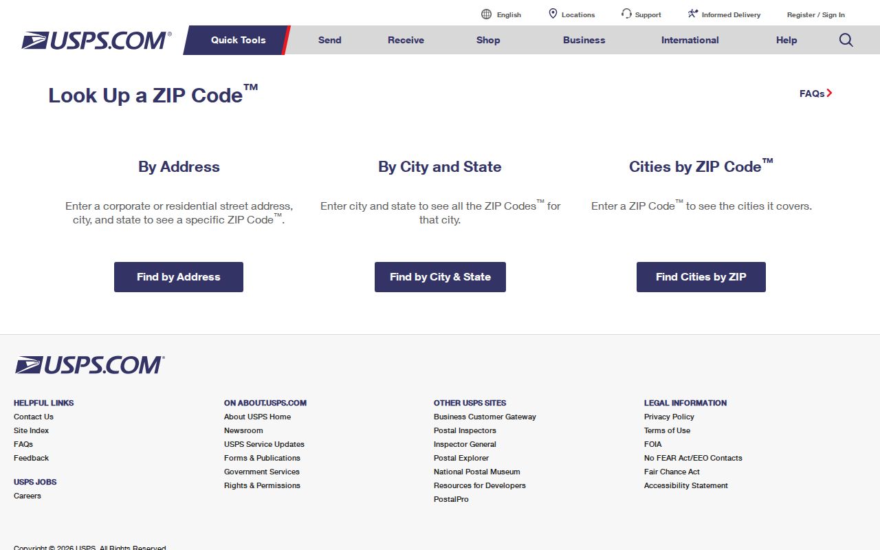
The USPS ZIP Code Lookup offers three routes: ZIP by address, ZIP by city and state, and cities by ZIP. Address mode is the strongest verification step. Enter the company only if relevant, the full street number and name, any unit, city, state, and an optional known ZIP. Preserve a 91- or 92- prefix because it is part of the Oʻahu address.
| USPS Field | Required | Use in Kapolei |
|---|---|---|
| Street address | Yes | Keep the hyphenated island number |
| Apt, suite, other | No | Add the unit when known |
| City | Yes | Test the source's Kapolei, Ewa, or Waipahu label |
| State | Yes | Select Hawaiʻi or HI |
| ZIP | No | Use a known code only for validation |
| City and state mode | Yes | Lists ZIPs linked to a place label |
Save the standardized result and access date. A preferred last-line city is not a municipal boundary or tax situs. The captured USPS lookup page shows the official tool used for this check.
Find Kapolei Records by ZIP
A ZIP code directory narrows the area before an official roll is searched. The Oʻahu ArcGIS parcel layer exposes a zip_code attribute, but it returns parcel features and map fields, not a roster of residents. RPAD documents address and TMK searches, not a verified ZIP filter. Voter OLVR verifies one person's own record and has no public ZIP-wide search.
- Verify the full address and standardized ZIP through USPS.
- Query the Oʻahu parcel layer by its ZIP attribute to find mapped parcels, site addresses, and TMKs.
- Open a parcel's RPAD link or search RPAD by address or TMK to read the owner and site fields.
- Use the TMK in BOC when the question concerns a recorded deed; BOC has no verified ZIP field.
- Once a street is known, use the Kapolei street directory for address-level work.
PVL's List Builder can sort regulated licenses by ZIP, island, license type, issuance, and status. That is professional-license geography, not household geography. The Covered Offender Search also documents a ZIP mode, but it is a specialized registry with identity and anti-harassment warnings, not a general directory.
Kapolei GIS ZIP Attributes
The official Oʻahu tax-parcel layer includes parcel geometry, TMK, site and mailing address fields, city, ZIP, and a link toward the public property card when available. A ZIP query can create a parcel set, then individual polygons can be checked against streets and nearby boundaries.
Mapped attributes need source discipline. A GIS ZIP value may lag a postal change, while the RPAD mailing address may point somewhere other than the physical parcel. Use USPS for delivery, GIS for map context, RPAD for the tax parcel, and BOC for recorded legal descriptions. The ZIP code directory should preserve those roles instead of treating the first matching field as final proof.
Note: The exact public HoLIS filter button was not captured; use the verified ArcGIS field and do not promise an unverified interface control.
Kapolei Address Prefix Clues
The 91- and 92- prefixes are strong west-Oʻahu search keys. Dropping the prefix can produce no result or a match to the wrong street. Keep punctuation, leading zeroes, and unit numbers when moving the same address among USPS, GIS, RPAD, and a directory source. The City describes an Oʻahu TMK with an island prefix and zone-sector-plat-parcel pattern, while RPAD may use a 12-digit parcel string.
A street address, TMK, condominium unit, lot and block, subdivision, and BOC legal description are different identifiers. A safe crosswalk is address to GIS and TMK, then RPAD parcel, then BOC document and legal description. Address records can also change through permitted new units, added dwellings, vacant-lot assignments, or corrections. No official citywide Kapolei renumbering year was found.
Kapolei, Ewa, Waipahu Edges
The Honolulu Neighborhood Commission street index routes Kakala Street and Kakuhihewa Street to Board 34 and Kapolei. The same official setting includes nearby Ewa with 96706 and Waipahu with 96797 labels. That makes the street index helpful for civic routing, but it is not a legal ZIP boundary map.
An address can therefore be locally described as Kapolei while a postal or agency system prints another nearby label. Run the same complete address through USPS, GIS, and RPAD, then record the exact label each source returns. Disagreement is useful evidence about source geography, not a reason to force every result into one place name.
Kapolei ZIP Boundary Limits
A ZIP is built for mail delivery. A Census ZIP Code Tabulation Area is a generalized statistical shape. A census-designated place is another statistical geography, not an incorporated city boundary. A parcel polygon and neighborhood-board district answer still other questions. Those layers can overlap without matching.
- ZIP and ZIP+4
- A five-digit delivery area and its more precise four-digit delivery segment.
- PO-box ZIP
- A code assigned mainly to post office boxes; no Kapolei secondary code was verified as this type.
- Unique ZIP
- A code assigned to one high-volume organization; none was verified for Kapolei.
- Carrier route
- A group of addresses served along one postal delivery route, not a city district.
A ZIP result cannot prove owner, occupant, voter status, or household ties. It narrows a delivery area. The official record tied to the actual question must do the rest.
Older Kapolei Address Searches
USPS is not the route for finding a past occupant. Historical work uses the UH, State Library, FamilySearch, Archives, and telephone-directory collections, followed by parcel and deed chronology. Modern Kapolei street patterns do not line up neatly with Honolulu directory runs from the nineteenth and twentieth centuries.
Search the exact printed place heading, including Ewa, Waipahu, Barbers Point, ʻEwa Plain, Honolulu, or Oʻahu when the record's era calls for it. A printed “r” beside a 1950s telephone entry is a researched format clue, but its full abbreviation key was not captured. Keep it as printed rather than defining it without evidence.
Pair a directory year with the nearest released federal census only after accounting for the 72-year rule. Hawaiʻi federal enumeration begins in 1900, while earlier Hawaiian censuses are separate record sets. Next, follow the address through its legal description and BOC instruments. A modern ZIP cannot be projected backward onto a street listing that predates the present postal or subdivision pattern.
The Kapolei Public Library can route a question that needs a newspaper, yearbook, or directory issue. The Hawaiʻi State Archives provides indexes and a research-room path, and UH collections supply Hawaiʻi genealogy and directory references. Ask for a title, year, volume, and call number. That request is more useful than asking a reference desk to search every person associated with a current ZIP.